The Ministry of Sustainable Development and Infrastructure yesterday announced that a new computer application, aimed at improving the parking of boats along the Moselle river through the use of information technology and geo-positioning, is now online.
The application was developed as part of the CoRISMa European project, which is funded by the European Union in the framework of the TEN-T programme, involving the five Member States of Austria, Belgium, Germany, the Netherlands and Luxembourg. The project has as its primary objective the continued development of River Information Services (RIS) with a view to improving the safety, reliability and efficiency of inland waterway transport.
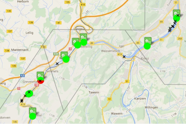
The Moselle project was amongst five pilot projects developed under the CoRISMa programmes and is the result of a collaboration between Luxembourg and Germany, providing a solution to boatmen by allowing them to find parking areas for their boats before the vessel arrives in a particular area of the river. The site display existing berthing places along the Moselle from Apach to Konz, their characteristics, current capacity and, where appropriate, reservations made for the them for the next 4-6 weeks.
The application was welcomed by the sector as a means of better visibility for boatmen, as well as a potential CO2 emissions saver through better planning.
CoRISMa seeks to advance the River Information Services (RIS) in Europe in particular by pooling data from terrestrial infrastructure of waterways, such as locks and ferry docks, with real-time vessel positions and logistical planning. CoRISMa also aims to contribue to RIS enabled corridor river management between different Member States located along major river routes through a coordinated and concerted development of RIS.
More information can be found at www.ris.eu or 75 00 48 1. The application is available at http://lux.d4d-portal.info.
Photo by MDDI


