The University of Luxembourg has launched the GR-Atlas 2.0, a modern mapping technology for the atlas of the Greater Region.
The renewed atlas of the Greater Region (GR-Atlas) is a collection of interactive thematic maps for the SaarLorLux Greater Region and a web geographic information system (WebGIS), which benefits researchers, as well as schools, residents and tourists.
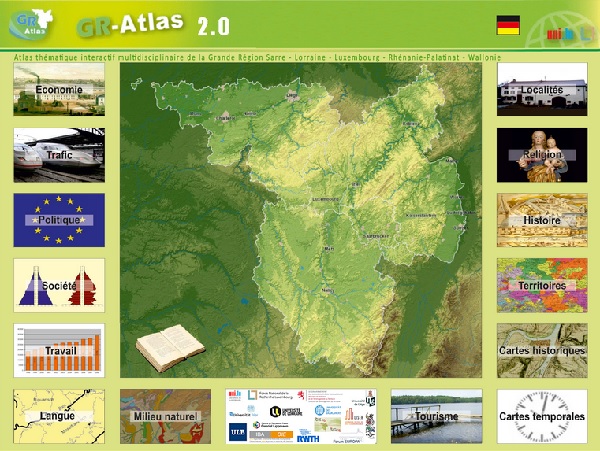
The first GR-Atlas was put online in 2009, as part of a research project led by Professor Michel Pauly and project partners. The website is available in German or French and consists of an interactive map section with currently close to 50 thematic maps and text units linked with the maps.
The interdisciplinary atlas covers a broad spectrum of topics, including natural environment, history, economy, society, transport and religion. It also contains unique topics like fuel tourism or the perception of the Greater Region in the media. Users can choose subcategories, whose locations are displayed on the map and icons indicate relevant information, historical data and website links. Notable highlights include time-controlled maps which display the chronological development of a phenomenon: for example how the borders have shifted between 1815 and today. In addition, the ability to combine maps allows one to recognise connections that would hardly have been noticed in the past.
Regarding changes to the atlas, the use of the altasFX technology from Trier-based GIS (Geographic Information System) company alta4 accommodates the user’s habits with an intuitive user interface, oriented around a Google Maps standard. An equally important aspect is increased security, which ensures that the interactive cartographic data on the internet can be used in the long-term.
The key new elements of the GR-Atlas 2.0 include an intuitive user interface that already shows initial information when you hover over areas, the separation of the maps by topics in order to speed up loading times, integration of numerous base maps, a newly developed tool for time-controlled interactive maps, adjustable transparency of different map layers and targeted links to individual maps or map sections from the text section.
The next goal for the GR-Atlas is the modernisation of the text section.


