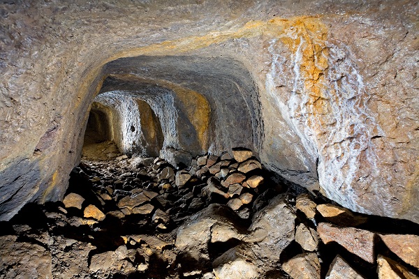
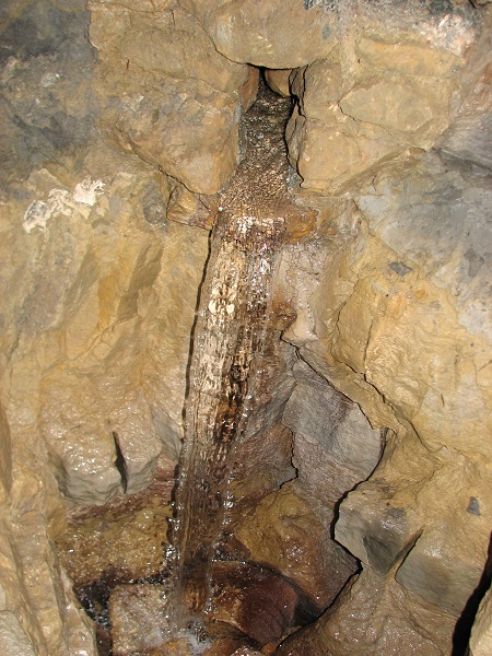
 Part of the gallery between P5 and P6;
Credit: J. Konen
Part of the gallery between P5 and P6;
Credit: J. Konen
Chronicle.lu has teamed up with Luxembourg's National Institute for Archaeological Research (Institut national de recherches archéologiques - INRA) for a series of articles on archaeological digs and discoveries around the Grand Duchy.
The series explores digs spanning from prehistoric to Roman and medieval times, highlighting key finds and what they reveal about Luxembourg’s past. It also sheds light on the work of the INRA and its approach to archaeological and historical research.
The latest article in this series looks at the Raschpëtzer Qanat, an underground aqueduct system located in the municipality of Walferdange.
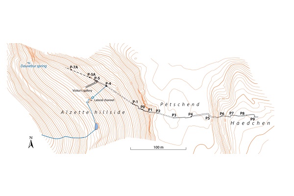
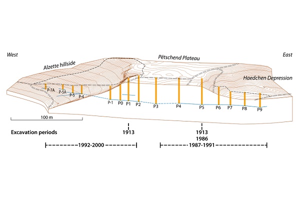
The Gallo-Roman Raschpëtzer aqueduct is an underground water supply system constructed according to qanat technology. It was built to transport drinking water to a Roman settlement. The subterranean system consists of a tunnel crossing from east to west a hard-rock sandstone horst, called the Pëtschend-plateau, at a depth of up to 35 metres and extending into the eastern slope of the fertile valley of the Alzette river. It includes a water conduit running at the top of an impermeable layer of marl and a series of 25 to 30 vertical shafts called “Raschpëtzer” connecting the tunnel to the surface. The total distance from the master shaft located in the Haedchen-depression to the final destination is about 800 metres.
In addition to a spring close to the bottom of the master shaft, the water supply comes from penetration through natural cracks and from infiltration through the pores of sandstone at the interfaces of marl and sandstone layers within the shafts. The water conduit was built in dry masonry and is covered by slabs of sandstone. The geological situation shows a slightly eastward dip of the sedimentary layers, which prevents the water within the aquifers to flow towards west; the qanat leads the water flow into opposite direction, i.e. westwards to the Roman settlements.
First excavations undertaken in 1913 did not yield any results. However, in 1967, excavations started again and led to the exciting discovery of the qanat in 1986. Subsequent excavations carried out with considerable financial and technical resources have made it possible to deal today with a partially restored qanat system presented to the public in a didactic way. The water flow rate of 180 m3 per day has remained more or less steady for the past fifteen years. The water has the quality of drinking water but is not used at present. Due to a geological accident which probably occurred close to the end of the Roman settlement in this region, the water disappears into the joints of limestone banks embedded in layers of marl and no longer reaches its original destination.
Further excavations are planned to discover the still-unexplored part of the qanat system, between the water disappearing location and the Roman settlement.
A 5.9 km circular trail (starting from Walferdange railway station) runs through the unique Sonnebierg nature reserve, along old rail tracks that recall the now-closed gypsum mines in Walferdange, and on to the Raschpëtzer Gallo-Roman qanat system. It is also possible to visit the Raschpëtzer site via a shortcut route starting at the car park adjacent to the CR125 road (GPS coordinates: 49.663410,6.155989).
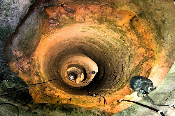
(Photo: Water disappears in the fissures of a limestone stratum under the breach in the channel floor near P5; Credit: G. Waringo)


