 Credit: Ali Sahib, Chronicle.lu
On the morning of Tuesday 9 September 2025, the Joint Operational Command Post (Poste de commandement opérationnel commun - PCO-C) issued its provisional report on the heavy rainfall and flooding across Luxembourg.
In line with the Luxembourg government's severe weather and flooding plan, the PCO-C convened at the National Crisis Centre in Senningen at 23:30 on Monday 8 September 2025. The interministerial operational unit brought together representatives of the Grand Ducal Fire and Rescue Corps (CGDIS), the National Roads Administration, MeteoLux, the Water Management Administration (AGE), the Grand Ducal Police and the High Commission for National Protection (HCPN).
The PCO-C's reported mission is to analyse, in collaboration with experts from the CERI assessment unit, the meteorological and hydrological situation, its impact, its consequences and possible scenarios. It also centralises human and material impacts and operational needs and coordinates interdepartmental interventions.
During the night from Monday to Tuesday, MeteoLux and the AGE recorded exceptional rainfall, with peaks exceeding 100 l/m² in Livange and Mersch and 90 l/m² in Walferdange (measured up to 04:00).
By 05:00 on Tuesday, the PCO-C drew an initial assessment as follows:
CGDIS: 298 interventions and more than 800 calls to the 112 emergency number. 21 municipalities were affected, including Luxembourg City, Bettembourg, Hesperange, Frisange, Roeser, Mondorf, Walferdange, Junglinster, Kopstal, Steinsel, Contern, Nommern, Mersch, Fischbach, Bettendorf, Diekirch, Parc Hosingen, Niederanven, Sandweiler, Garnich and Bertrange. Seven people were rescued from three different cars (no injuries). Sixteen intervention and rescue centres (CIS) and three specialised intervention groups (GIS) were mobilised. The Operations Management Centre (CGO) was activated, and 200 firefighters were deployed.
Police: 30 interventions and 70 calls to 113 emergency number.
National Roads Administration: 50 calls relating to floods and fallen trees; 20 roads were closed. UPDATE: The Roads Administration later on Tuesday morning reported that its staff had carried out 47 interventions, most of which were due to fallen trees, flooding and landslides. In total, about 50 road sections were affected by the bad weather, most of which were around Luxembourg City. The teams were "doing their utmost" to make them accessible "as quickly as possible".
Authorities expected rainfall intensity to decrease from 05:00 onward. Forecasts indicated that the rain would move towards Germany, with drier conditions expected around 10:00.
Within the AGE measuring network, red alert thresholds were exceeded at Pfaffenthal and Steinsel. However, it is possible that this threshold will also be exceeded at the Mersch station. Despite the heavy rainfall, widespread flooding was avoided thanks to effective absorption by soil and vegetation.
There is currently a red-level flood warning in place for southern Luxembourg, from 07:00 to 18:00 on Tuesday. Significant overflows are possible, even in areas that rarely flood. This poses risks to both people and property. More information is available at www.inondations.lu.
UPDATE: On Tuesday, the Grand Ducal Police warned motorists to continue to avoid the Däich car park in Ettelbruck due to the risk of flooding. The police also advised checking closed routes and expecting traffic disruptions, respecting road closures and detours and, if necessary, following the instructions of local officials, as well as adapting one's driving style to the weather conditions.
The list of closed roads was as follows:
1. CR115 Stegen-Schrondweiler
2. CR158 Roeser-Kockelscheuer (Roeser)
3. CR171 Sandweiler-Schrassig
4. CR233 Rue du cimetière Luxembourg-Luxembourg
5. N13 Bettembourg-Hellange
6. CR345 Ettelbruck-Grentzingen
7. N14 Diekirch-Stegen
8. N2 Sandweiler-Sandweiler
9. CR159 Itzig-Sandweiler
10. N14 Diekirch-Gilsdorf
11. N52 Limpertsberg Luxembourg-Luxembourg
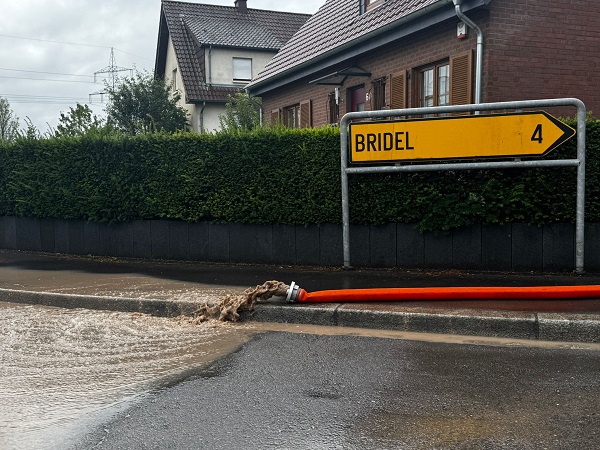
12. CR181 Bridel-Bereldange
13. CR347 Stegen-Schieren
14. N1 Senningen-Senningerberg
15. N7 Lintgen-Rollingen
16. CR101 Kopstal-Schoenfels
17. N28 Bous-Oetrange
18. CR123 Moesdorf (Mersch)-Moesdorf (Mersch)
19. CR121 Blumenthal-Reilänner Millen
20. CR118 Mersch-Angelsberg
During the night, the police specified that: Place François-Joseph Dargent in Luxembourg-Eich was closed due to flooding; the Rangwee tunnel was only partially accessible; the CR158 Bivingen (Roeser) section was closed in both directions; the tunnel at the Serra roundabout in Luxembourg-Kirchberg was flooded and should be avoided; Rue d'Oetrange in Schrassig was no longer accessible; a tree had fallen across the street on Rue de la Cimetière in Luxembourg-Beggen, blocking both lanes; iIn Ettelbruck, one lane towards Welsdorf was closed due to a landslide; the road near the Q8 station in Luxembourg-Pulvermühle was flooded.
Among the places hit by the heavy rain was the Schueberfouer in Glacis, Luxembourg-Limpertsberg. The City of Luxembourg (VdL) has been providing live updates of the flooding situation in the capital, where several bus routes have been impacted: https://www.vdl.lu/fr/actualites/risque-dinondations
Updated to include additional information about road closures and interventions carried out by the Grand Ducal Police and the National Roads Administration.


